LiDAR scanning
High-precision aerial laser scanning for terrain mapping and 3D models, even in remote, dense forests, or hard-to-reach areas
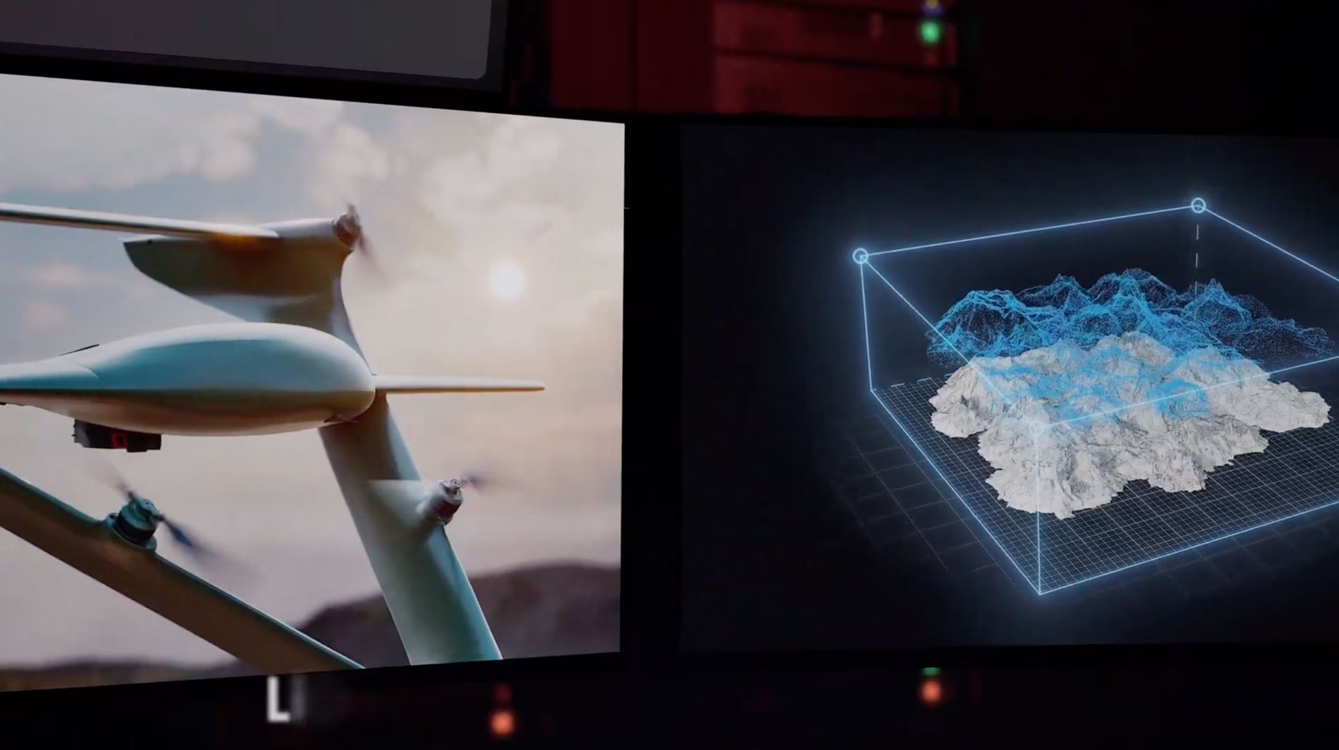
High-precision terrain capture from the air. FIXAR platforms carry LiDAR scanners to collect dense 3D point clouds of landscapes, infrastructure, or natural formations, even in forests, mines, or urban environments
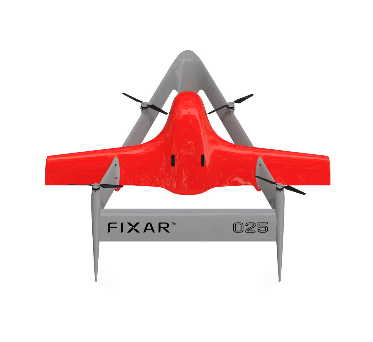
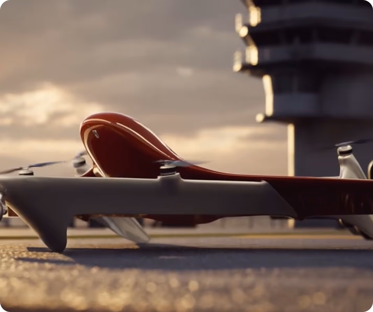
FIXAR VTOL design
Allows heavy payload-to-maximum takeoff weight capacity to carry LiDAR and camera sensors simultaneously
Autonomous surface tracking
Maintains low-altitude cruise over uneven terrain
Post-mission 3D output
Ready for CAD software, planning, or reconstruction workflows

advantages in
action
LiDAR-optimized platform
Stable airframe ensures clean scan lines with minimal vibration, maintaining dense point clouds even at high flight speeds
Auto-altitude control
Maintains consistent AGL with real-time surface track-and-follow
Multi-sensor
Integrates GNSS for geo-referenced cloud generation and RGB data for 3D point cloud texturing
Maximum performance in scanning
The software selects the most efficient route to ensure automatic high-quality data collection
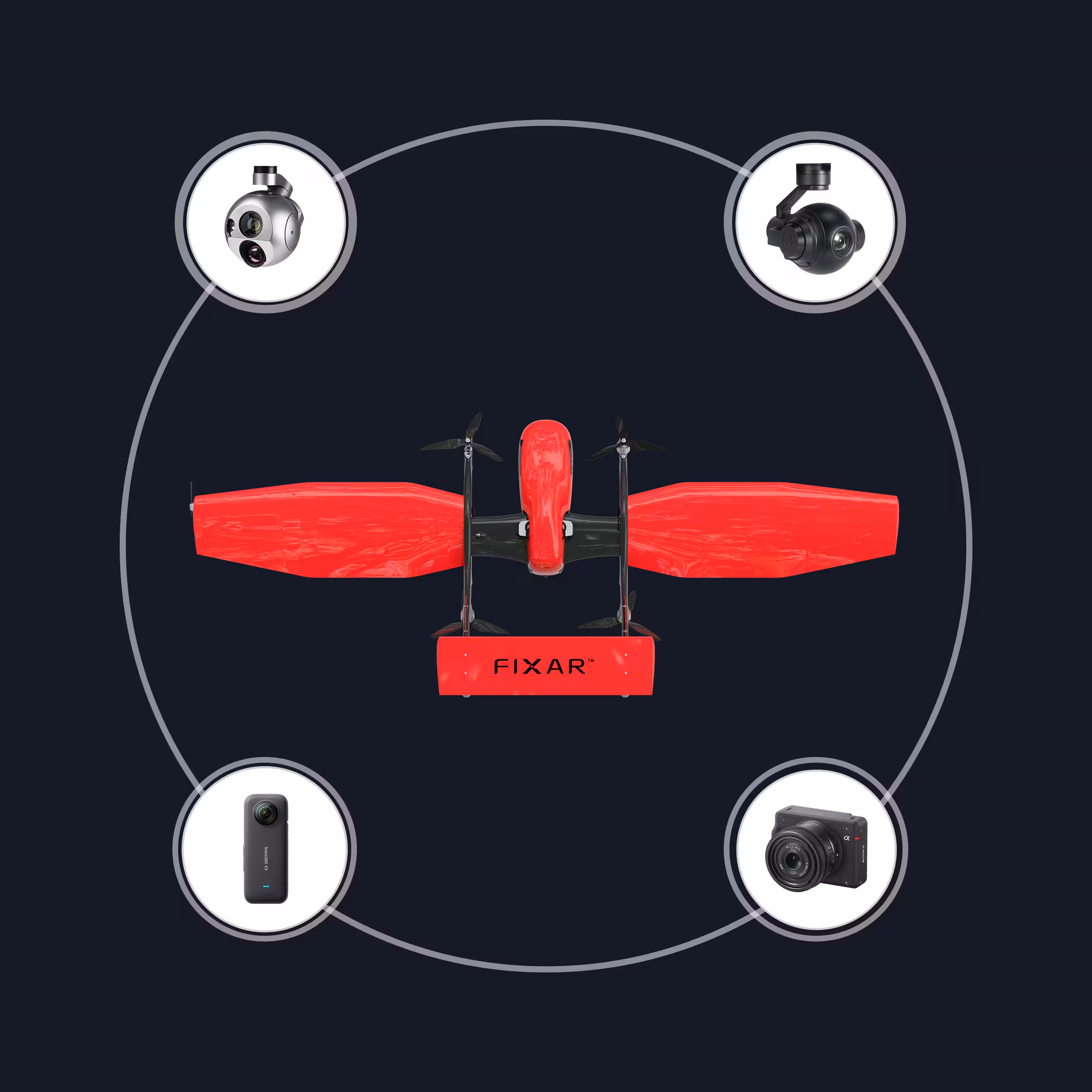
Recommended modules
PhaseOne P5 35 мм
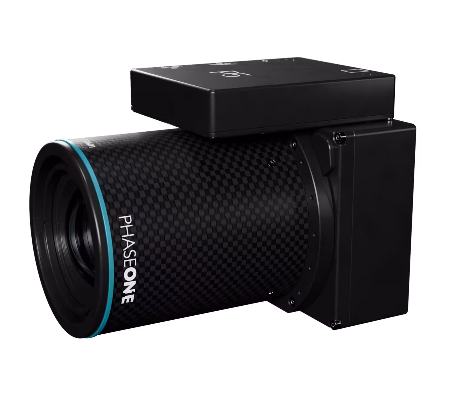
128 MP next-gen aerial camera; 35 mm favors efficient area coverage with survey-grade quality. Built for consistent, repeatable mapping
Weight: 0.6 kg / 1.4 lb
Resolution: 128 MP
Sensor format: Medium format
Lens focal length: 35 mm
GSD @ 100 m / 328 ft: 1 cm/px
Shutter type: Electronic global
PhaseOne P5 80 мм
128 MP camera with an 80 mm lens to push ground resolution on critical surveys. Ideal for detailed inspection and precision mapping
Weight: 1.2 kg / 2.7 lb
Resolution: 128 MP
Sensor format: Medium format
Lens focal length: 80 mm
GSD @ 100 m / 328 ft: 0.4 cm/px
Shutter type: Electronic global
PhaseOne iXM-GS120 80 мм
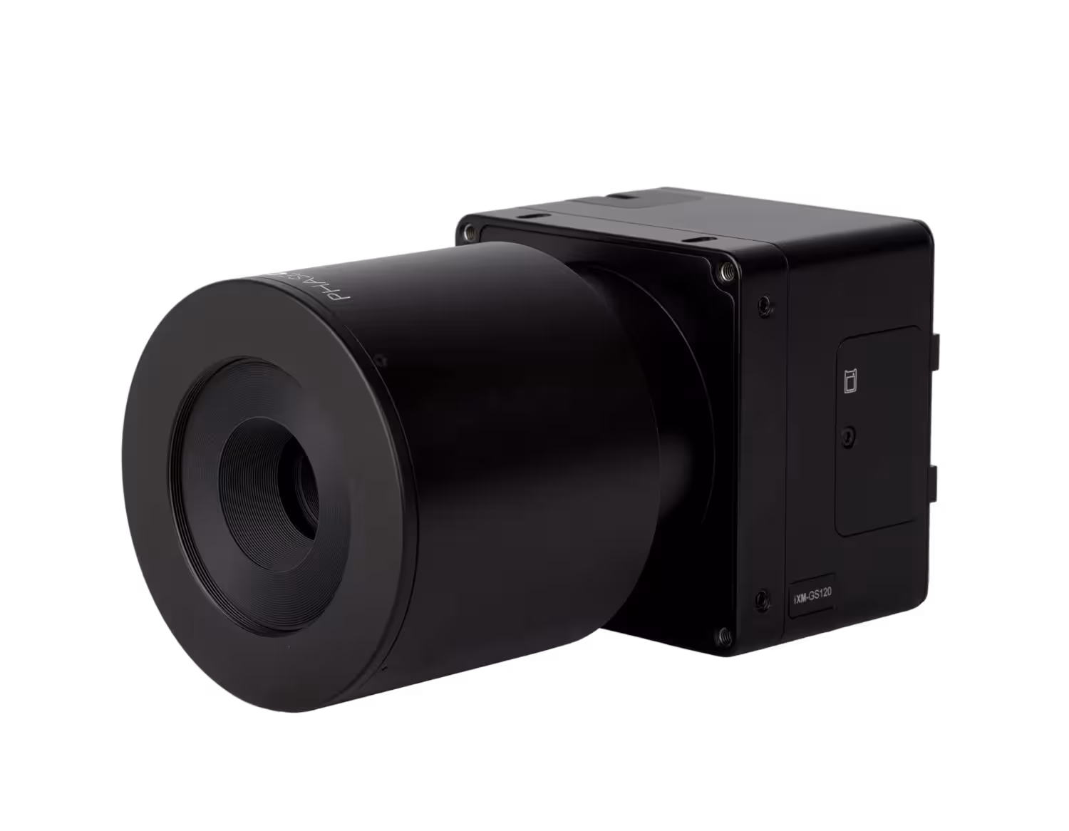
120 MP global-shutter platform with an 80 mm lens for finer ground detail. Suited to assets and corridors that need higher precision
Weight: 1.1 kg / 2.5 lb
Resolution: 120 MP
Sensor format: Medium format
Lens focal length: 80 mm
GSD @ 100 m / 328 ft: 0.4 cm/px
Shutter type: Electronic global
PhaseOne iXM-GS120 35 мм
120 MP global-shutter aerial camera with a 35 mm lens for high-throughput surveys. Delivers sharp geometry with rapid capture cycles
Weight: 1.1 kg / 2.5 lb
Resolution: 120 MP
Sensor format: Medium format
Lens focal length: 35 mm
GSD @ 100 m / 328 ft: 1 cm/px
Shutter type: Electronic global
Merio Milvus MLV_14Z
Compact daylight + thermal gimbal with infrared optical zoom. Efficient fit for long-endurance monitoring and basic evidence capture
Weight: 2 kg / 4.4 lb
EO optical zoom: 30×
IR resolution: 640×480
IR optical zoom: 5×
LRF: 12 km / 7.5 mi (≈ 39,370 ft)
Stabilization: 3-axis
AI object tracking: Yes
Merio Milvus MLV_10М

Lightweight stabilized daylight camera for simple, reliable viewing. Suited to basic monitoring with minimal payload weight
Weight: 0.7 kg / 1.4 lb
EO video: up to 1080p
EO optical zoom: 10×
Stabilization: 3-axis
Storage: microSD
IR: No
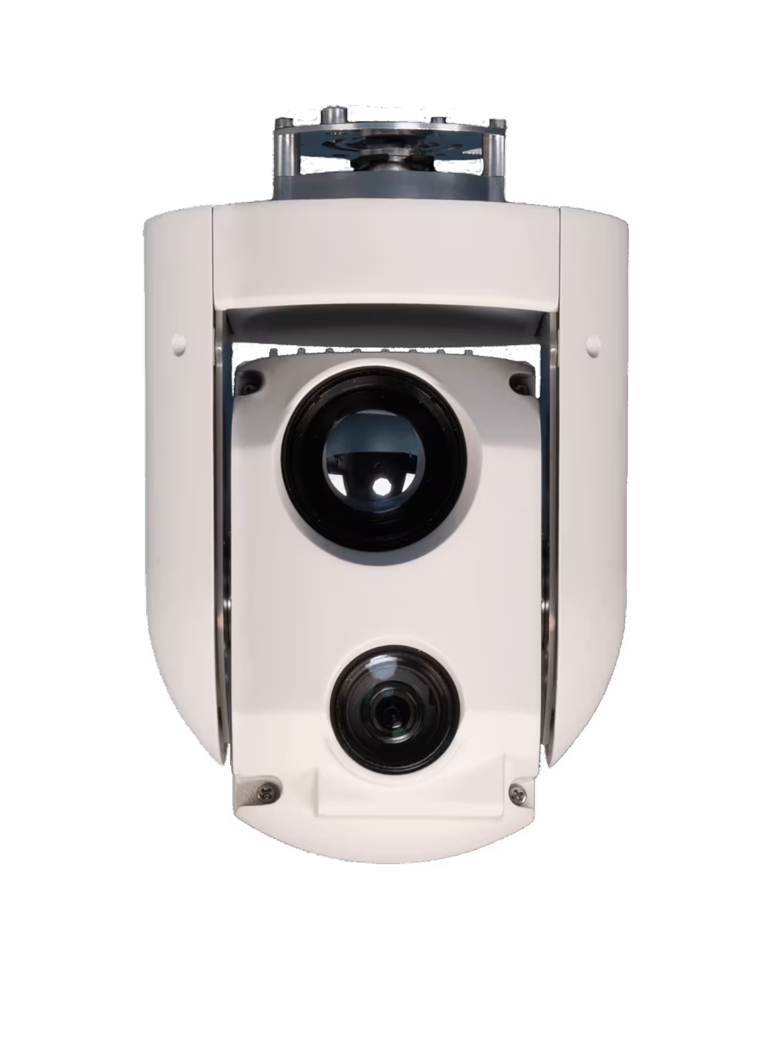
Merio Temis XL (2-axis)
_converted.avif)
Simple, robust stabilized gimbal with daylight/thermal options and add-on modules (tracking, ranging). Practical when low weight and straightforward operation are priorities
Weight: 1.1 kg / 2.4 lb
EO optical zoom: 30×
IR resolution: 640×480
IR optical zoom: Fixed (no optical zoom)
LRF: No
Stabilization: 2-axis
AI object tracking: Yes
Micasense RedEdge-P
Five narrow bands plus a panchromatic channel for pan-sharpened outputs. Standard choice for vegetation indices and crop/land monitoring
Weight: 0.4 kg / 0.8 lb
Spectral bands: Blue (475 nm), Green (560 nm), Red (668 nm), Red Edge (717 nm), NIR (842 nm) + Panchromatic
Resolution: 1456×1088 (1.6 MP per MS band) + 2464×2056 (5.1 MP Pan)
Shutter: Global shutter
FOV: 49.6° (H) × 38.3° (V) (MS) / 44.5° (H) × 37.7° (V) (Pan)
GSD @ 120 m / 400 ft: 7.7 cm/px / 3 in/px (MS), 4 cm/px / 1.6 in/px (Pan)
Topodrone P24 12 мм
24 MP platform with a wider 12 mm lens for faster coverage and colorizing LiDAR data. Good for large areas at lower altitude
Weight: 0.5 kg / 1 lb
Resolution: 24 MP
Sensor format: APS-C
Lens focal length: 12 mm
GSD @ 100 m / 328 ft: 3.3 cm/px
Shutter type: Mechanical
Nextvision Raptor

Deep optical zoom and long-range thermal performance with strong stabilization. Designed for demanding surveillance at extended distances
Weight: 0.6 kg / 1.4 lb
EO video: up to 1080p
Total zoom: 80×
IR resolution: 1280×720
LRF: No
Stabilization: 3-axis
Protection: IP54
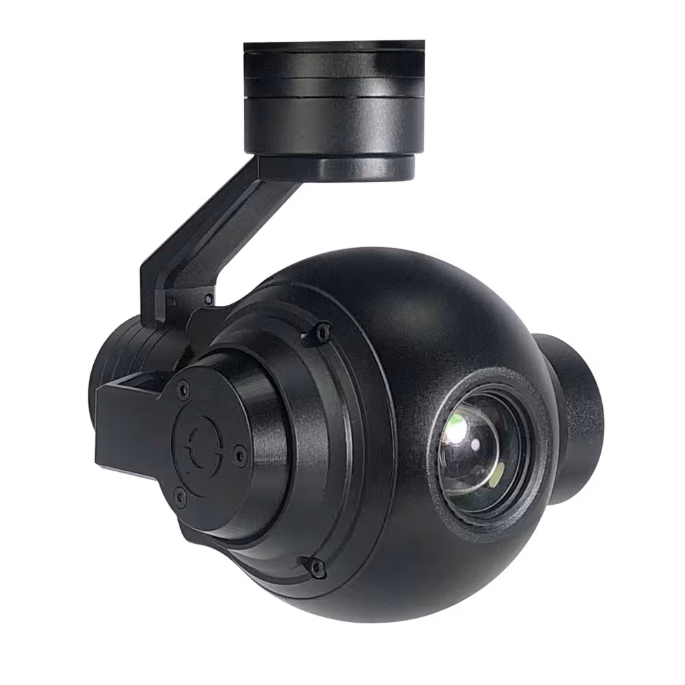
Nextvision Dragon Eye II

Ultra-light daylight + thermal gimbal that maximizes endurance without sacrificing stable imaging. Good for long patrols and mobile targets
Weight: 0.1 kg / 0.3 lb
EO video: up to 1080p
EO optical zoom: 40×
IR resolution: 640×480
IR zoom: 4×
LRF: No
Stabilization: 3-axis
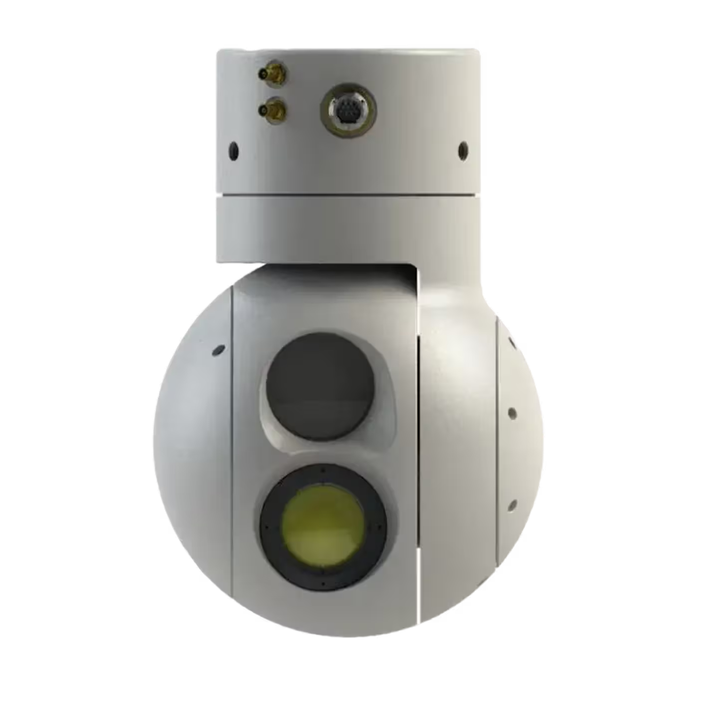
ViewPro A10T
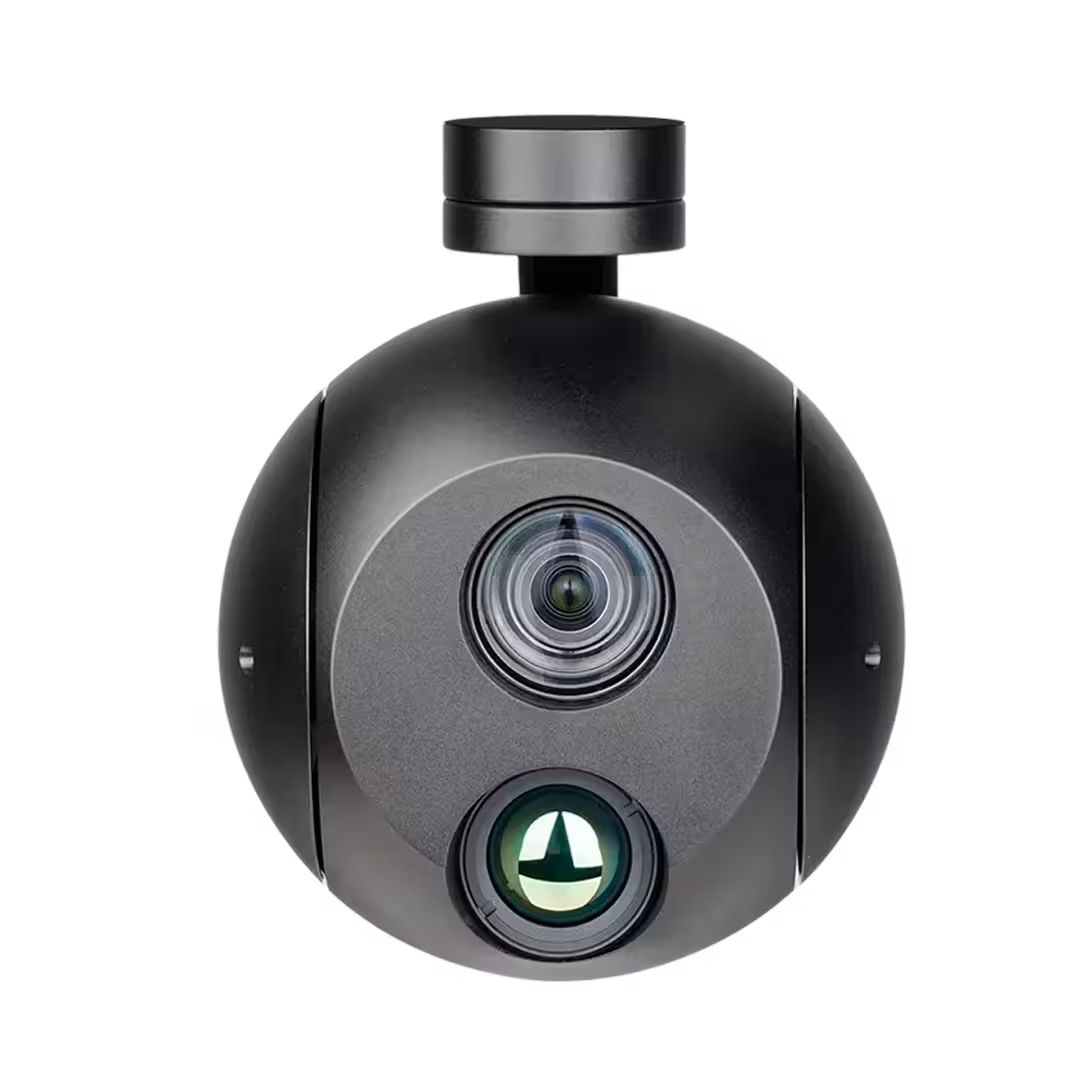
Dual-sensor daylight + thermal gimbal with built-in tracking. Lightweight option for inspections and search tasks with clear day/night visuals
Weight: 0.6 kg / 1.3 lb
EO optical zoom: 10×
IR resolution: 640×512
IR optical zoom: 1×
LRF: No
Stabilization: 3-axis
AI object tracking: Yes
ViewPro Q10
Stabilized daylight zoom for clear long-range visuals when thermal is not required. A cost-effective tool for inspection and general observation
Weight: 0.5 kg / 1.1 lb
EO video: up to 4K
EO optical zoom: 10×
Stabilization: 3-axis
Horizontal FOV: 66.4°
Storage: microSD up to 512 GB
IR: No
ViewPro A10TR
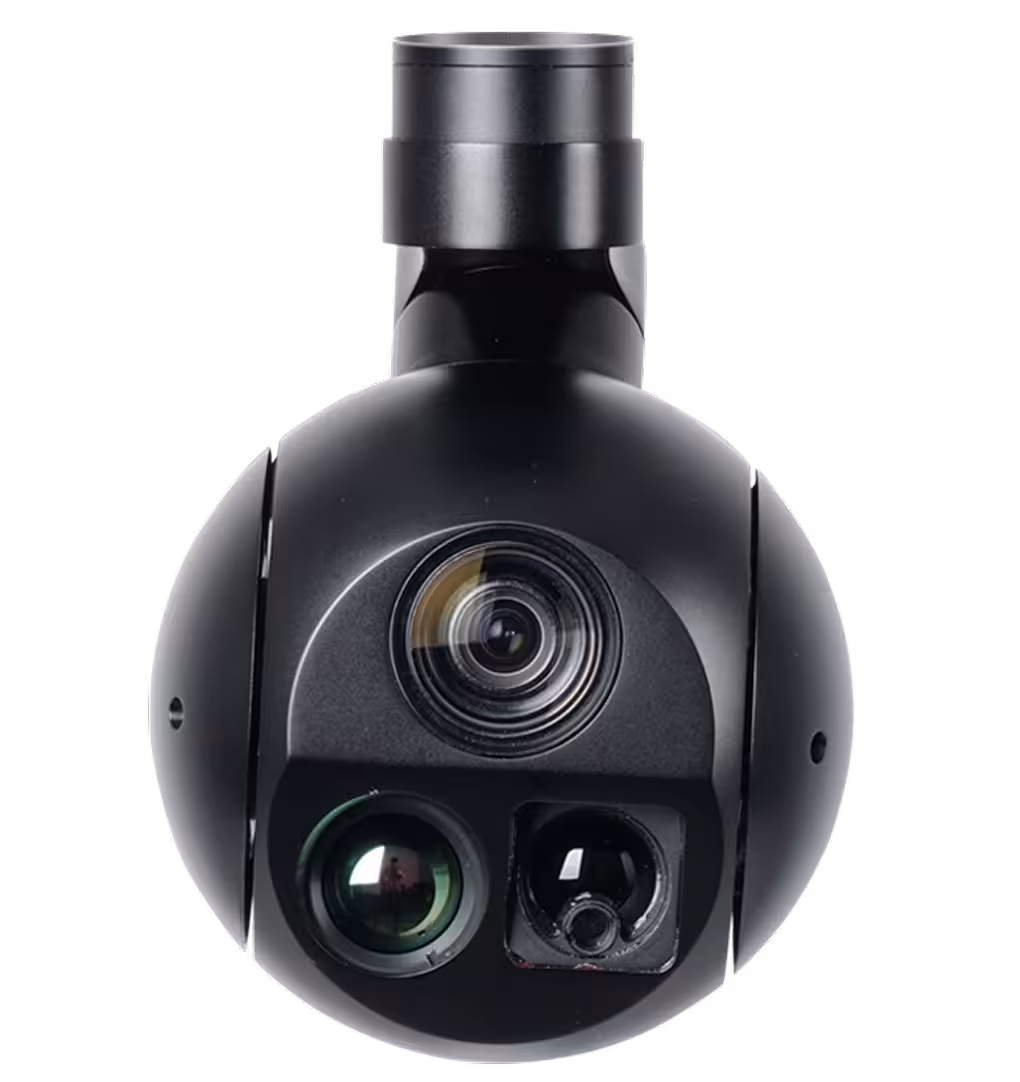
Compact three-in-one gimbal (daylight, thermal, rangefinder) with tracking. A balanced choice for search, incident assessment, and routine monitoring
Weight: 0.7 kg / 1.4 lb
EO optical zoom: 10×
IR resolution: 640×512
IR optical zoom: 1×
LRF: 1.5 km / 0.9 mi (≈ 4,921 ft)
Stabilization: 3-axis
AI object tracking: Yes
Riegl VUX-180-24

High-speed LiDAR for fast, precise nadir scanning on complex sites. Used when capture speed and accuracy are critical
Weight: 2.7 kg / 5.9 lb (without IMU/GNSS)
Max range: 1,520 m / 4,987 ft
Max effective measurement rate: 2,000,000 meas./sec
FOV: 75°
Accuracy (1σ): 10 mm / 0.4 in
Protection class: IP64
IMU/GNSS: optional
Topodrone P24 21 мм
24 MP mapping setup tuned for consistent area capture with a 21 mm lens. Works smoothly with PPK for precise geotagging
Weight: 0.5 kg / 1 lb
Resolution: 24 MP
Sensor format: APS-C
Lens focal length: 21 mm
GSD @ 100 m / 328 ft: 1.8 cm/px
Shutter type: Mechanical
Merio Temis XL14HD
High-resolution thermal-first gimbal for clean heat-signature detection at range. Ideal when thermal evidence is the main objective
Weight: 1.6 kg / 3.4 lb
EO optical zoom: 30×
IR resolution: 1280×1024
IR optical zoom: Fixed (no optical zoom)
LRF: Optional
Stabilization: 2-axis
Insta360 X3
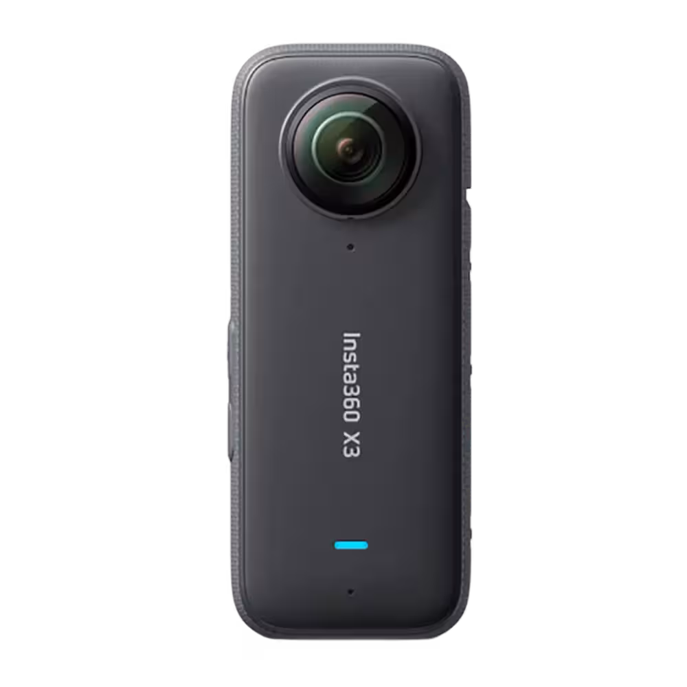
Adds 360° situational awareness and reframable video for quick scene capture. Useful for documentation, training, and after-action review
Weight: 0.2 kg / 0.4 lb
360° video: 5.7K (5760×2880) @ 30 fps
Photo: 72 MP
Waterproof: 10 m / 33 ft
Battery life: up to 81 min
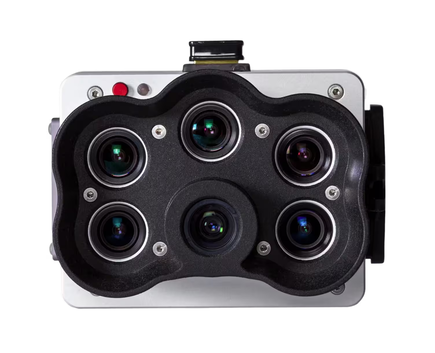
Agrowing Sextuple (ILX-LR1 addon)
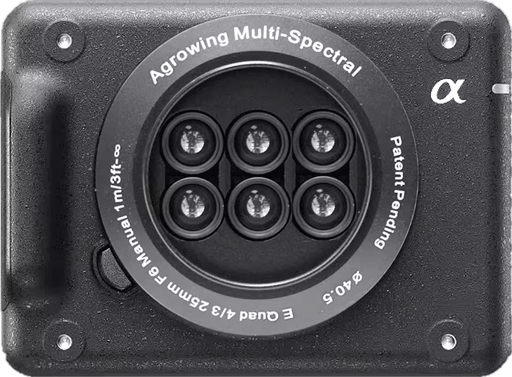
Sextuple-band lens kit that turns the ILX-LR1 into a multispectral camera. Captures RGB and multispectral data in one workflow
Weight: 0.4 kg / 0.9 lb
RGB resolution: 61 MP
Multispectral: 14-band, 7.2 MP per band
Bands (nm): 405, 430, 450, 490, 525, 550, 560, 570, 630, 650, 685, 710, 735, 850
Lens focal length: 21.8 mm
FOV: Diagonal 40.8° / Horizontal 33° / Vertical 25°
ViewPro A40TR-35
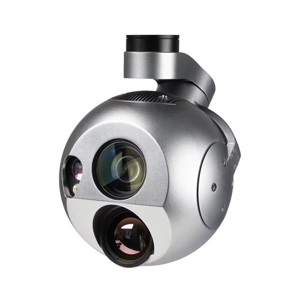
40× daylight zoom with thermal, autonomous detection/tracking, and long-range distance measurement. Suited for standoff observation where quick identification matters
Weight: 1.2 kg / 2.6 lb
EO optical zoom: 40×
IR resolution: 640×512
IR optical zoom: 1×
LRF: 3 km / 1.9 mi
Stabilization: 3-axis
AI object tracking: Yes
Topodrone LiDAR 200+

Airborne LiDAR package with onboard motion/positioning for survey-grade point clouds. Suitable for terrain models, corridors, and site scans
Weight: 0.7 kg / 1.6 lb
Max range: 300 m / 984 ft
Point rate: 640k–1.9M pts/s
Laser returns: Single / Dual / Triple
FOV: 360° (H) × 40.3° (V)
Channels (lines): 32
Accuracy: 3–5 cm / 1.2–2 in
Protection class: IP67
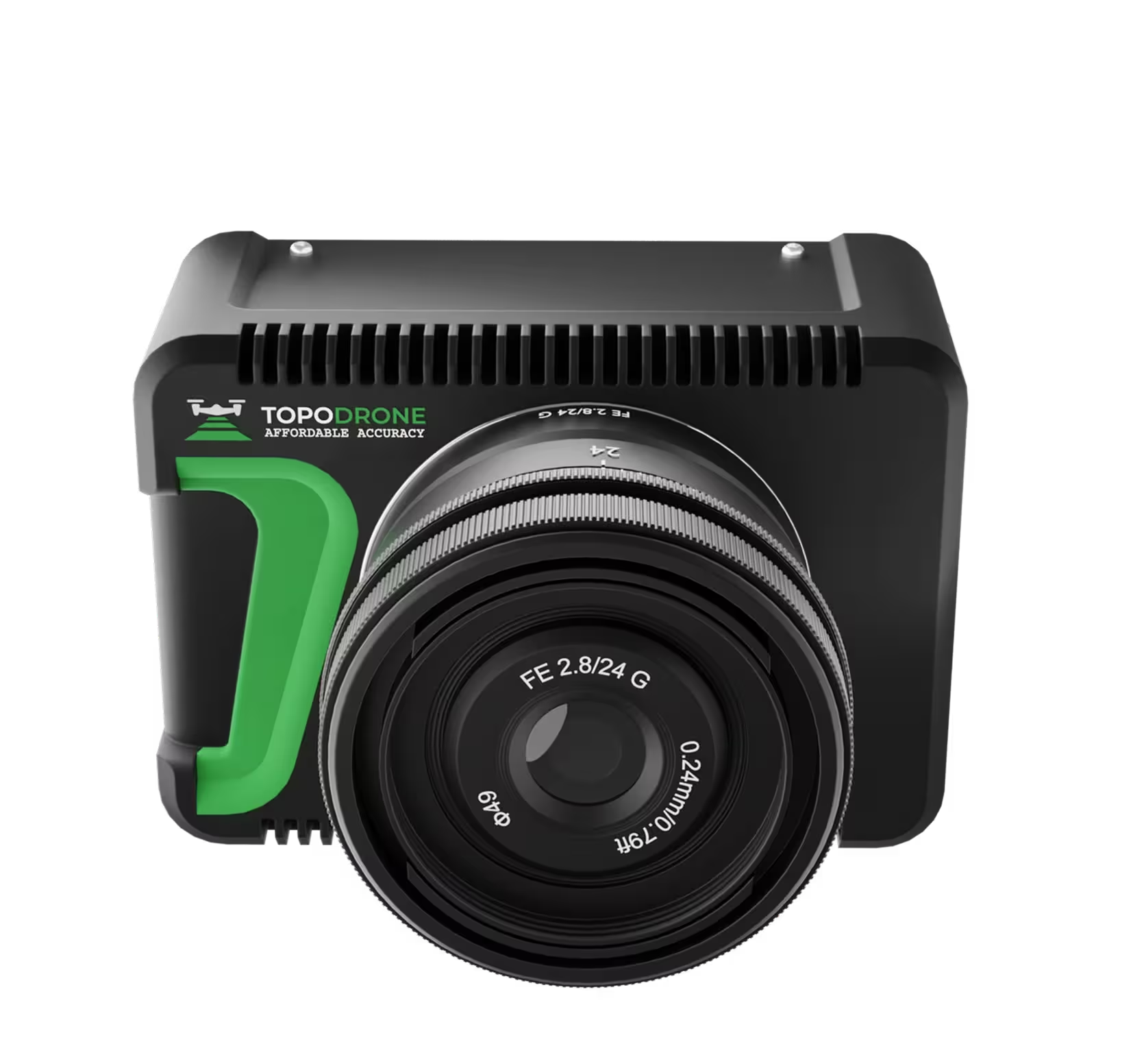
Sony ILX-LR1
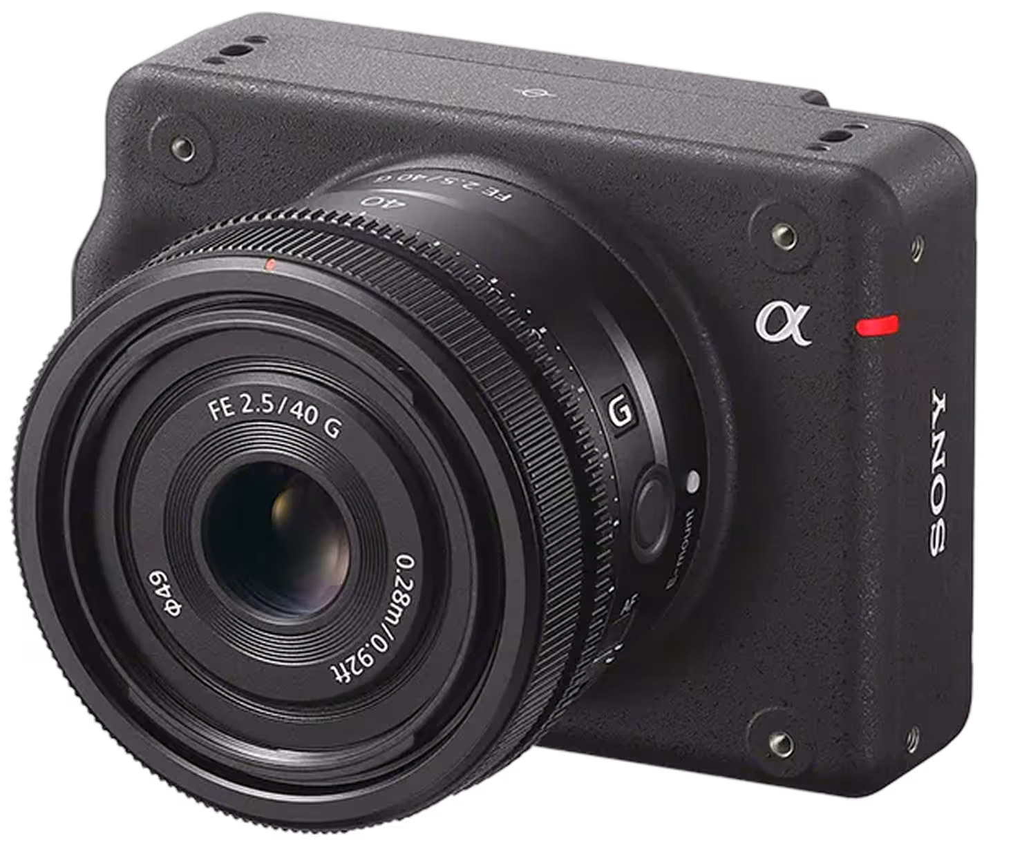
61 MP interchangeable-lens industrial camera for sharp maps and inspections. Lightweight body supports long flights and accurate photogrammetry
Weight: 0.7 kg / 1.5 lb
Resolution: 61 MP
Sensor format: Full-frame
Lens focal length: 35 mm
GSD @ 100 m / 328 ft: 1 cm/px
Shutter type: Mechanical / Electronic
ViewPro A40TR
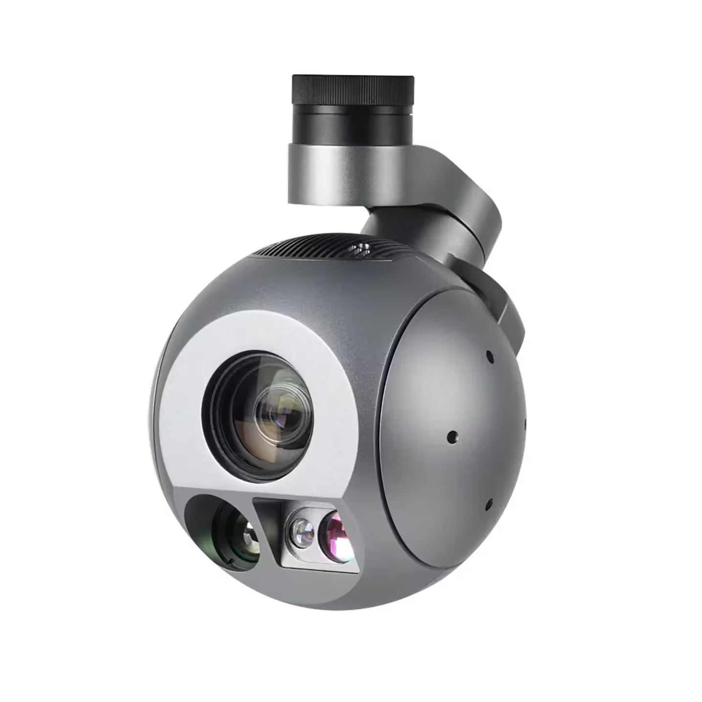
40x daylight zoom plus thermal and a laser rangefinder with auto-tracking for fast target lock and coordinates. Adds reliable long-range day/night awareness for patrol and response
Weight: 1.1 kg / 2.5 lb
EO optical zoom: 40×
IR resolution: 640×512
IR optical zoom: 1×
LRF: 3 km / 1.9 mi (≈ 9,843 ft)
Stabilization: 3-axis
AI object tracking: Yes
Recommended products
FIXAR 007 LE007 LE
7 kg MTOW
71 km flight distance
100 min flight time

Previous application
Detecting illegal activities
Identify and track illegal activities such as fishing, poaching, and drug cultivation in remote areas
Previous application
Pursuit and tracking
AI tracking ensures continuous suspect surveillance while reducing officer risk and enabling dynamic target following

Previous application
Evidence collection
Capture high-resolution aerial imagery and 3D scene mapping for crime scene analysis and detailed forensic reconstructions
Previous application
SWAT and tactical operations
Live aerial video for high-risk missions like hostage rescues, enabling detailed recon of buildings and areas before entry

Previous application
Traffic and road safety
Enhance road safety through live traffic monitoring, automated violation detection, and rapid response to accidents
.avif)
Previous application
Border patrol and surveillance
Detect unauthorized crossings and smuggling operations by monitoring vast border areas in real time
Previous application
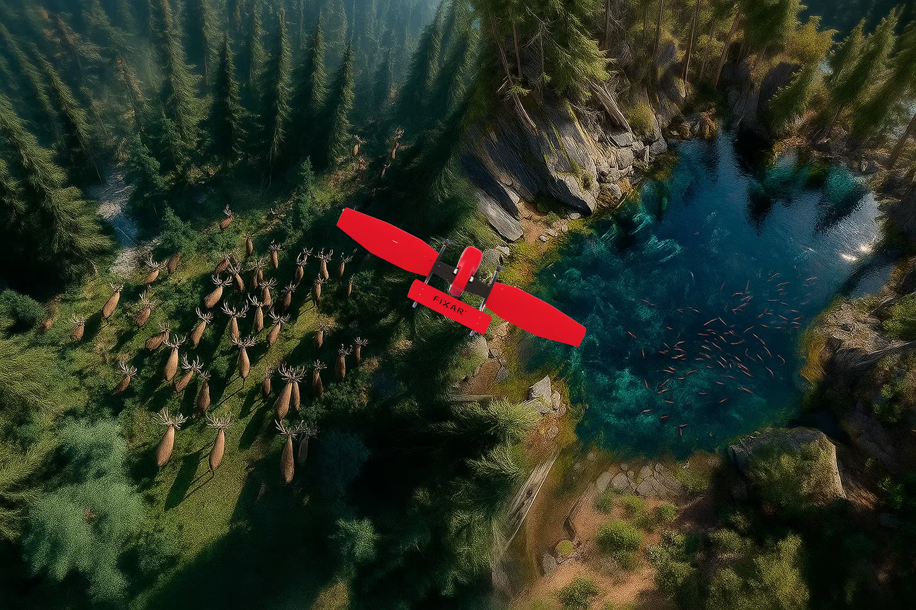
Wildlife observation on land and water
Monitor wildlife, track migration, and habitat changes on land and water without disturbing ecosystems
Previous application
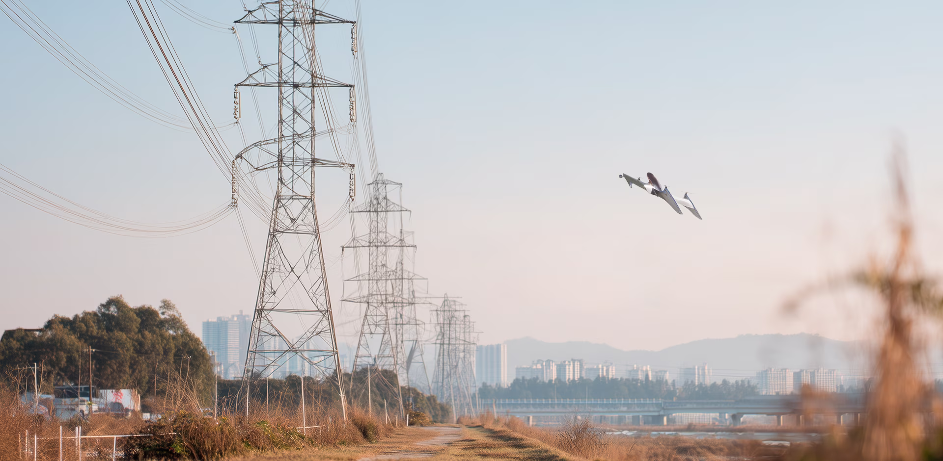
Infrastructure monitoring
Automated inspections of critical infrastructure such as gold mining sites, oil and gas pipelines, bridges, power lines, and facilities to reduce costs and enhance safety
Previous application
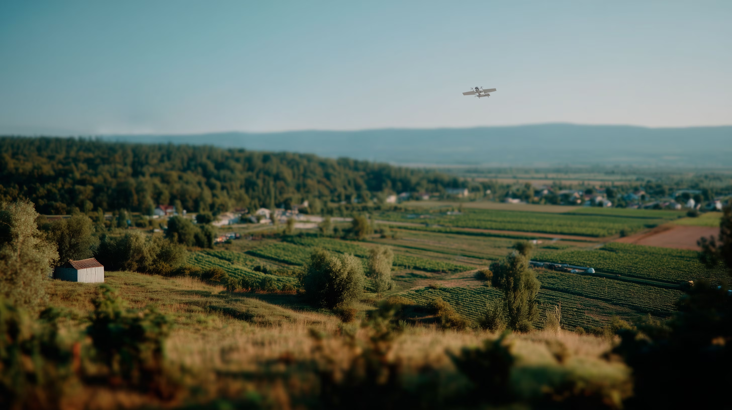
Precision agriculture and forest valuation
Optimize crop management and forest valuation via aerial monitoring, detecting vegetation index, soil conditions, moisture levels, drainage forecasting, supporting organic farming, and refining field boundaries and maps

Previous application
Mapping
Capture high-resolution aerial images and geospatial data to deliver RGB/multispectral photos. Resulting in orthomosaics and 3D models (DSM, DEM), produced for construction, urban planning, moisture control, flood monitoring, surface mines, etc
Previous application
LiDAR scanning
High-precision aerial laser scanning for terrain mapping and 3D models, even in remote, dense forests, or hard-to-reach areas

Previous application
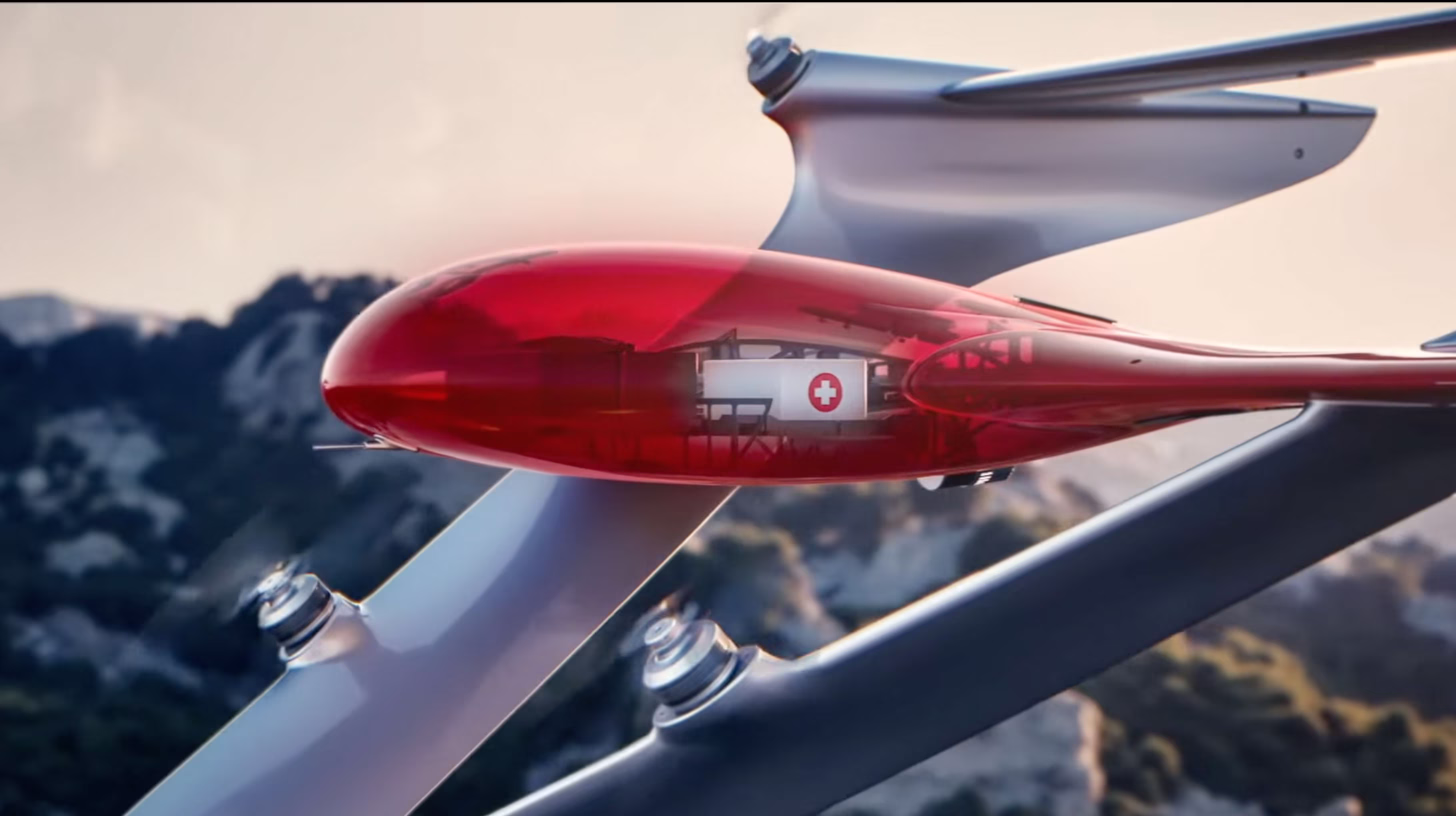
Medical and vital goods delivery
Fast, reliable transport of medical supplies, vaccines, and essential goods to remote areas or during emergencies

Previous application
Fire response and incident assessment
Deliver real-time aerial intelligence on critical situations such as fires, hazardous material spills, or structural collapses
.avif)
Previous application
Disaster management and recovery
Assess damage from natural disasters like floods, earthquakes, or wildfires, and identify survivors in need of rescue
Previous application
Remote communication and control
Utilize UAVs as mobile communication mesh in areas with limited infrastructure or during large-scale emergencies
Previous application
Emergency response
Assist in delivering critical supplies and medicine to disaster-stricken or inaccessible locations
.avif)
Previous application
Search and rescue operations
Deploy thermal imaging and night vision payloads to locate missing persons in remote or hard-to-reach areas

Next application
Detecting illegal activities
Identify and track illegal activities such as fishing, poaching, and drug cultivation in remote areas
Next application
Pursuit and tracking
AI tracking ensures continuous suspect surveillance while reducing officer risk and enabling dynamic target following
Next application
Evidence collection
Capture high-resolution aerial imagery and 3D scene mapping for crime scene analysis and detailed forensic reconstructions
Next application
SWAT and tactical operations
Live aerial video for high-risk missions like hostage rescues, enabling detailed recon of buildings and areas before entry
Next application
Traffic and road safety
Enhance road safety through live traffic monitoring, automated violation detection, and rapid response to accidents
Next application
Border patrol and surveillance
Detect unauthorized crossings and smuggling operations by monitoring vast border areas in real time
Next application
Wildlife observation on land and water
Monitor wildlife, track migration, and habitat changes on land and water without disturbing ecosystems
Next application
Infrastructure monitoring
Automated inspections of critical infrastructure such as gold mining sites, oil and gas pipelines, bridges, power lines, and facilities to reduce costs and enhance safety
Next application
Precision agriculture and forest valuation
Optimize crop management and forest valuation via aerial monitoring, detecting vegetation index, soil conditions, moisture levels, drainage forecasting, supporting organic farming, and refining field boundaries and maps
Next application
Mapping
Capture high-resolution aerial images and geospatial data to deliver RGB/multispectral photos. Resulting in orthomosaics and 3D models (DSM, DEM), produced for construction, urban planning, moisture control, flood monitoring, surface mines, etc
Next application
LiDAR scanning
High-precision aerial laser scanning for terrain mapping and 3D models, even in remote, dense forests, or hard-to-reach areas
Next application
Medical and vital goods delivery
Fast, reliable transport of medical supplies, vaccines, and essential goods to remote areas or during emergencies
Next application
Fire response and incident assessment
Deliver real-time aerial intelligence on critical situations such as fires, hazardous material spills, or structural collapses
Next application
Disaster management and recovery
Assess damage from natural disasters like floods, earthquakes, or wildfires, and identify survivors in need of rescue
Next application
Remote communication and control
Utilize UAVs as mobile communication mesh in areas with limited infrastructure or during large-scale emergencies
Next application
Emergency response
Assist in delivering critical supplies and medicine to disaster-stricken or inaccessible locations
Next application
Search and rescue operations
Deploy thermal imaging and night vision payloads to locate missing persons in remote or hard-to-reach areas
.svg)
.avif)
.avif)
.svg)
.svg)
.svg)